


Sunday, 18, January, 2026

"Pingali Venkayya: The Visionary Behind India’s Tricolour Legacy"1

→

"Pingali Venkayya: The Visionary Behind India’s Tricolour Legacy"
From Nation, For Nation - Pulse of the Nation
Zero Mile
Zero Mile

"From Colonial Zero Mile to Karaundi's Ashoka Pillar – Tracing the Shifting Geographical Heart of Independent Modern India"

Geographical Centre of Historic and Modern India
Nagpur is historically known as the geographical centre of India, marked by the iconic Zero Mile Stone. Erected by the British, this sandstone monument features a pillar and four majestic horses, and was used to measure distances across colonial India. The pillar has carvings of distances to major cities, reinforcing Nagpur’s central importance.

Centre of Modern India – Karaundi
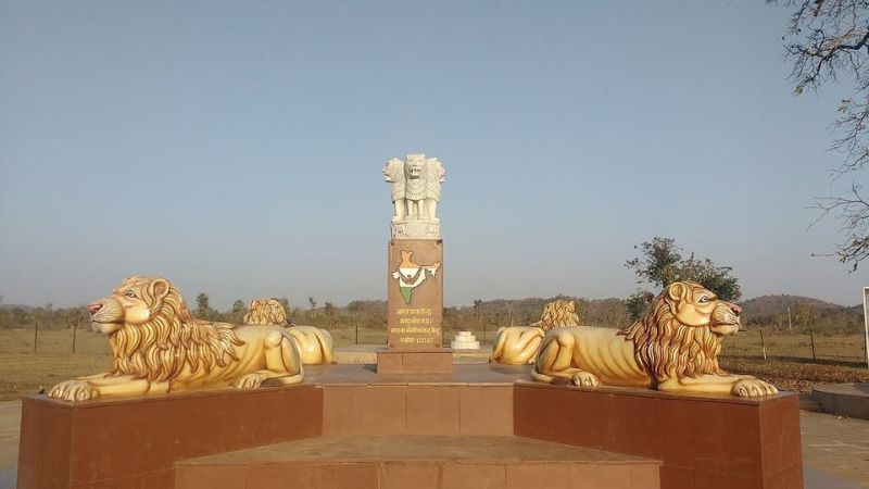
Following the Partition, India’s topography changed, and the geographical centre shifted from Nagpur to Karaundi in Madhya Pradesh. Located at 23.48°N, 80.12°E with an elevation of 386 meters, Karaundi now represents the modern heart of India. An Ashoka Pillar monument, featuring four lions facing each direction, stands tall in a field, signifying this updated central point.

→

Voice
Voice

Lata Mangeshkar – The Voice That Unites a Nation

Indian Book of Records proudly honors Lata Mangeshkar as a Lead Indian, whose timeless voice echoes in every heart. →
From Globe, For Globe - Pulse of the Planet
Bose
Bose
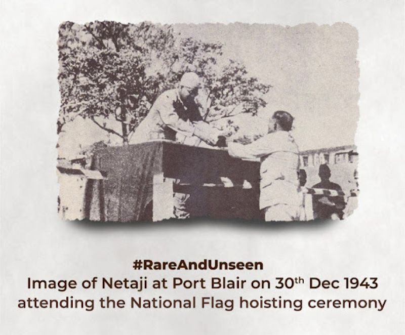
Netaji Bose Declares Andaman and Nicobar as Shaheed and Swaraj Islands in Freedom’s Fiery Dawn

It was the pre-independence era. World War II had impacted the entire world. On 30 December 1943, the Indian National Army, under the leadership of Netaji Subhas Chandra Bose, declared the Andaman and Nicobar Islands as part of Independent India and renamed them ‘Shaheed-deep’ (Martyr Island) and ‘Swaraj-dweep’ (Self-ruled Island). →